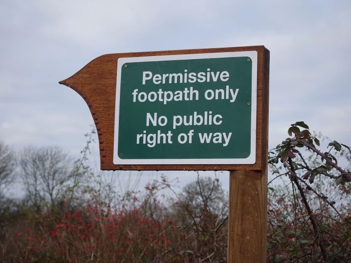
Several new footpath signs were recently erected near the airfield.
They start at the entrance on the Aylesbury Road (opposite the footpath to Chearsley) and are repeated along the path, at Pegasus Way and at the entrance to the path alongside the railway track.
They are part of the signage for the redirected footpath on the Airfield site, on which new homes are to be built.
Planning permission was granted for the erection of up to 233 residential dwellings, provision of 4.85 hectares of employment land, relocation and extension of existing playing fields with new community pavilion and associated car parking, a retail convenience store, 64 bed care home, open space and landscaping (application reference: 14/03289/AOP). You can read more about this development here.
The permission was subject to a Section 106 Agreement that required a 'permissive footpath' to be implemented along the western and northern boundary of the site.
In reality the path has existed for some time, of course. However, last month the Developers (Lands Improvement) asked Bucks CC to confirm that providing the 'permissive path' had met the requirements of Section 106.
The Haddenham Safe Walking and Cycling Group was asked by Bucks CC for comments. The Group submitted some comments as regards the start point, but essentially said it was fine. The signs themselves, however, were not as hoped for – especially given the prominent "no public right of way" statement: legally true, no doubt, but a perhaps little officious.
After an approach to Lands Improvement by the Safe Walking & Cycling Group, the signs have now been taken down again, and will be replaced with alternatives offering additional information about the route.
For more information, contact Jim Robinson, Email: jim.robinson@wychert.co.uk
In Other News...


